
An Anthropocene Archive in Searsville Reservoir
The Anthropocene has arrived, and at Jasper Ridge, we have been using a record of the past century archived in Searsville Reservoir to understand what that means. The Anthropocene is being proposed as a new geologic epoch by an international group of investigators, to recognize an emerging body of evidence that humans have changed the planet so dramatically that the geological deposits forming now have characteristics that are unique in Earth’s history. Part of this process involves hunting for the geological deposits that best illustrate the physical, chemical, and biological changes that set the Anthropocene apart from deposits that characterize earlier geological epochs. Jasper Ridge is one of nine sites in the world that now are being studied intensively in this regard. Among these nine sites, Jasper Ridge is unique in that the sediments have accumulated as a direct consequence of human activity—the emplacement of the dam—and so Searsville elegantly embodies the Anthropocene.
In collaboration with a fellow scientists here at Stanford University and at other institutions around the globe, the approach I’m taking is detailed analysis of sediment cores to identify global and local geological signals that can distinguish the Anthropocene from the preceding epoch, the Holocene, and to mark its beginning, which is thought to be around the year 1950 by the international group of scholars studying this question, the Anthropocene Working Group.
Sediment cores from lakes store a diverse array of information about the past biodiversity and environmental conditions both within and around the lake. They are collected by drilling into the sediments at the bottom of the lake using a hollow tube or pipe, commonly made of either aluminum or plastic. Once collected, the cores are split lengthwise, and the sediments can be analyzed for a variety of biologic and geochemical data.
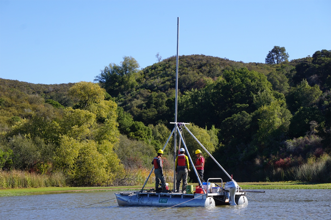
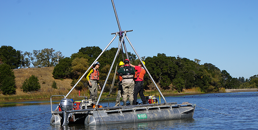
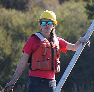
Figure 1. Process of coring Searsville reservoir at Jasper Ridge Biological Preserve.
In October of 2018, I joined a team from Jasper Ridge and the United States Geological Survey to collect four cores from Searsville Reservoir (Fig. 1). The reservoir first filled in 1892 and, today, around 11 meters of sediment have accumulated behind the dam. This provides us with a remarkable, high-resolution record of the last 126 years. If we assume constant rates of sedimentation, this means that we have around 7cm of sediment per year—in contrast, most sediment cores have a resolution of around 1mm per year. The high sedimentation rate of the Searsville basin means we should be able to distinguish events year by year, if not season by season, over the last century.
The information I will tease out of the cores is anticipated to enable us to learn how local drivers—including geologic events like earthquakes, environmental changes like climate, and human impacts like logging, livestock, and agriculture—did or did not trigger biologic changes at Jasper Ridge, which include vegetation change, shifts in presence and abundance of terrestrial vertebrates, and changes in the aquatic ecosystem. At the same time, isotopic and sedimentological information gleaned from the cores has great potential to highlight global signals of the Anthropocene, such as a change in carbon isotopes associated with nuclear testing, or the rise in carbonaceous particles associated with increased burning of fossil fuels.
In effect, the cores provide a lens through which to view how the past became the present, and how species at Jasper Ridge interacted with their environment over the last century. Such information is essential to understand the baseline of ecological change that can help us foresee and, when needed, manage future changes.
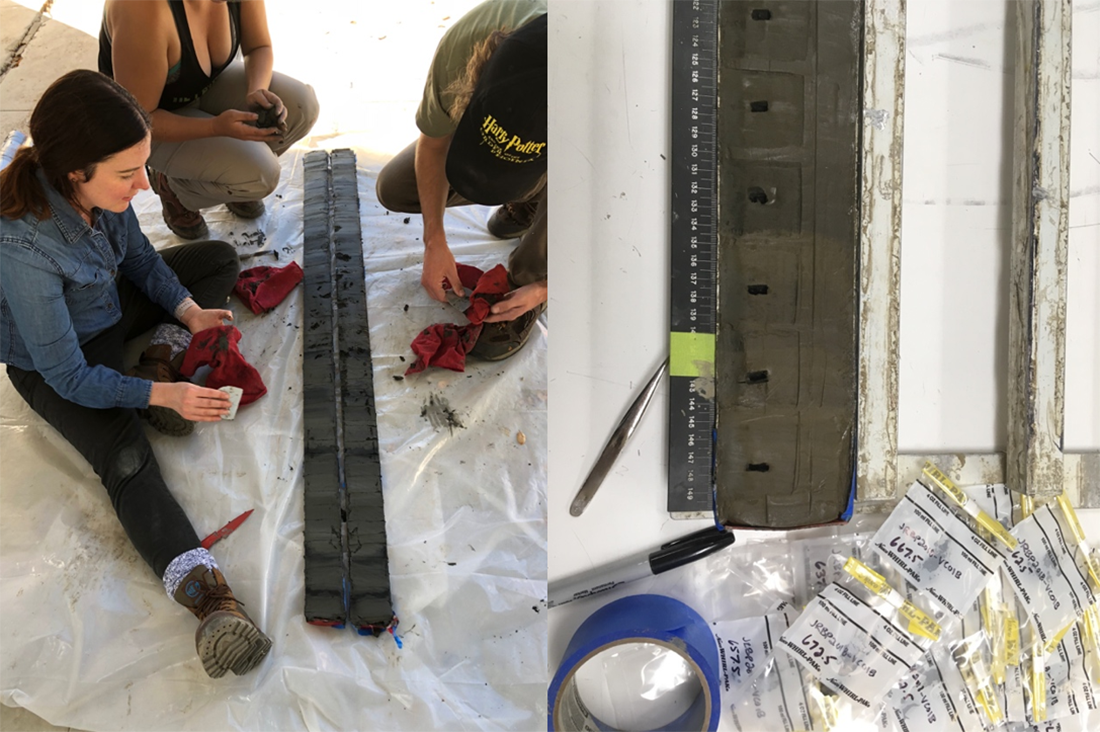
Figure 2a and 2b. After extracting the cores from the reservoir, they were split and photographed (2a) prior to more detailed extractive sampling (2b)
How are the cores analyzed? One of the four Searsville cores was split and photographed in the field to get a quick first look at the sedimentary record and to prepare it for further analysis (Fig 2ab). Then all four cores were taken to the USGS laboratories in Santa Cruz and stored in a large walk-in refrigerator designed specifically for core storage (Fig. 3). Over the last 4 months, the cores have undergone a series of scans including high-resolution imaging, computed tomography (CT) scanning, and X-ray fluorescence (XRF). CT scans show us three-dimensional differences in sediment density, which in turn tells us where there are major changes in the sediment that are not always visible to the naked eye. In this core, we found very fine layers in the CT scans, as well as zones of sediment mixing which are indicative of some kind of major disturbance (possibly earthquakes). XRF measures elemental composition of the sediments, so we know how the concentration of things like iron, calcium, titanium, and various other elements change along the length of the core. From this data, we will be able to extract information like where sediments are originating in the watershed, when there were major changes in precipitation, and when anthropogenic inputs like copper-containing algaecides were used to control aquatic weeds.
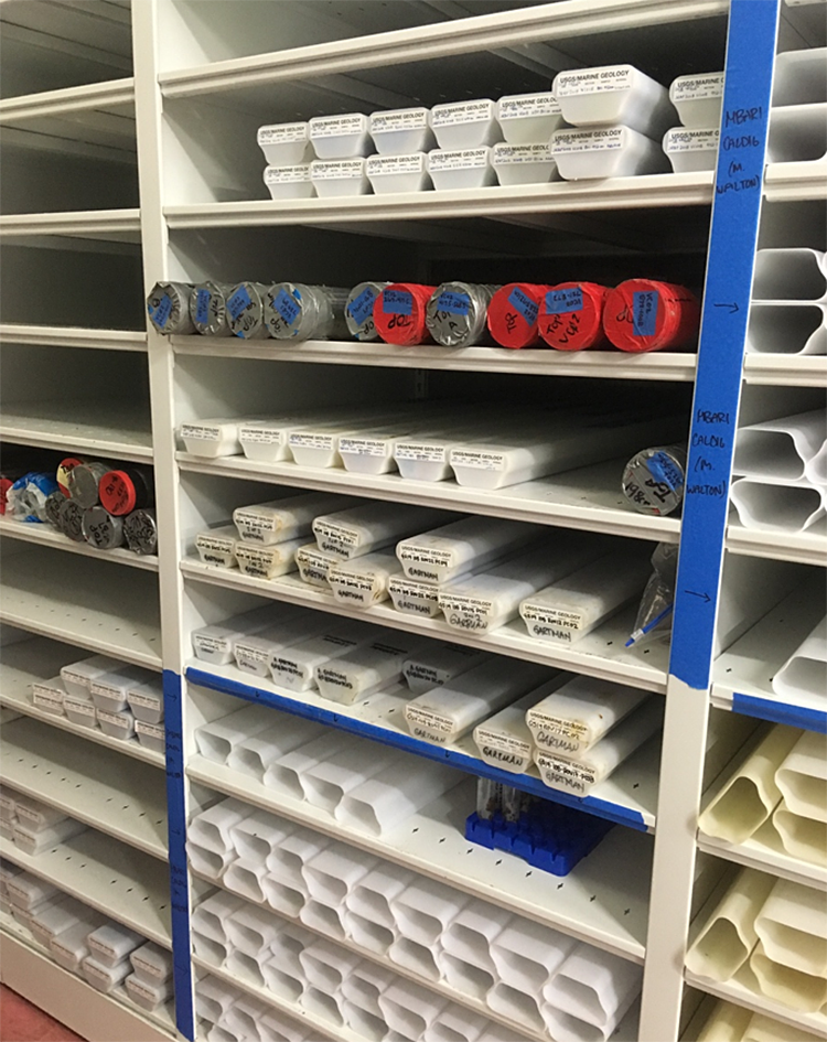
Fig 3. Part of the large walk-in refrigerator in the Santa Cruz USGS laboratories designed specifically for core storage.
We are now in the process of analyzing indicators needed to understand how global signals of the Anthropocene—e.g., radionuclides from nuclear testing, nitrogen (N) and carbon (C) isotopes, components of black carbon, atmospheric pollutants like lead (Pb), and other anthropogenic inputs—match up with local manifestations of human impacts. At the end of the process, the data from Jasper Ridge will be combined with data coming from the other eight sites being studied around the world—ranging from caves, to coral reefs, to estuaries (including south San Francisco Bay)—to give a clear picture of when the Anthropocene—effectively the Age of Humans—began, and how much we have changed the world.
Over the course of multiple seasons, you notice many small changes here at Jasper Ridge—different plants leafing out and blooming, more dust in the air as the summer wears on, etc. Little changes accrue across the years, as well—for example, tarweed has recently become more common at the field station. In one form or another, these changes are captured in the sediments of the lake, so as you walk around Jasper Ridge, reflect on the history-in-the-making that you see around you, and how future researchers might recover that history from paleoecological archives like lakes in the future.
Nature magazine news feature article featuring Allison’s work and citing faculty director Liz Hadly: “Humans versus Earth: the quest to define the Anthropocene“
Learn more about this research at https://jrbp.stanford.edu/research/projects/geological-signals-anthropocene-sediment-cores-searsville-reservoir
 Dr. M. Allison Stegner is post-doctoral researcher at Jasper Ridge Biological Preserve and focuses her work in the fields of paleoecology and conservation biology. You can learn more about Allison and her research in her website (https://allisonstegner.com) and follow her on Twitter for more updates @allison_stegner