Jasper Ridge Eddy Flux station

Summary
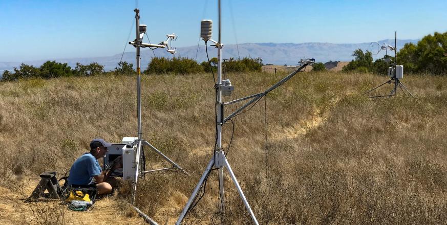
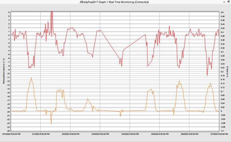
The Jasper Ridge Eddy Flux station provides data that can be used to address questions that span many different times scales and spatial scales: 1) how do different ecosystems respond to environmental changes? 2) how do changes in ecosystem metabolism feed back to affect the environment? 3) are natural ecosystems in equilibrium with respect to carbon gain and loss, or are they progressively storing more carbon? 4) is climate change shifting the growing season in natural ecosystems?
Jasper Ridge is one of hundreds of stations making similar measurements around the globe. Data from these stations also provide ground information to compare with estimates of net primary production, evaporation, and energy absorption derived from remote-sensing instruments on satellites and aircraft. A 1993 paper from Jasper Ridge was one of the first to use eddy flux ground-truthing to demonstrate that airborne imaging spectroscopy can be used to estimate spatial and temporal variation in ecosystem productivity. Another paper, in 1995, provided an early demonstration of the use of eddy flux approaches for measuring ecosystem properties, such as the efficiency with which solar radiation drives ecosystem photosynthesis, that could be summed across scales from the region to the globe. Data from the eddy flux station also complement those from nearby ground-level sensors that monitor vegetation, such as a phenocam.
▶VIDEO: Chris Field explains how an eddy flux station works
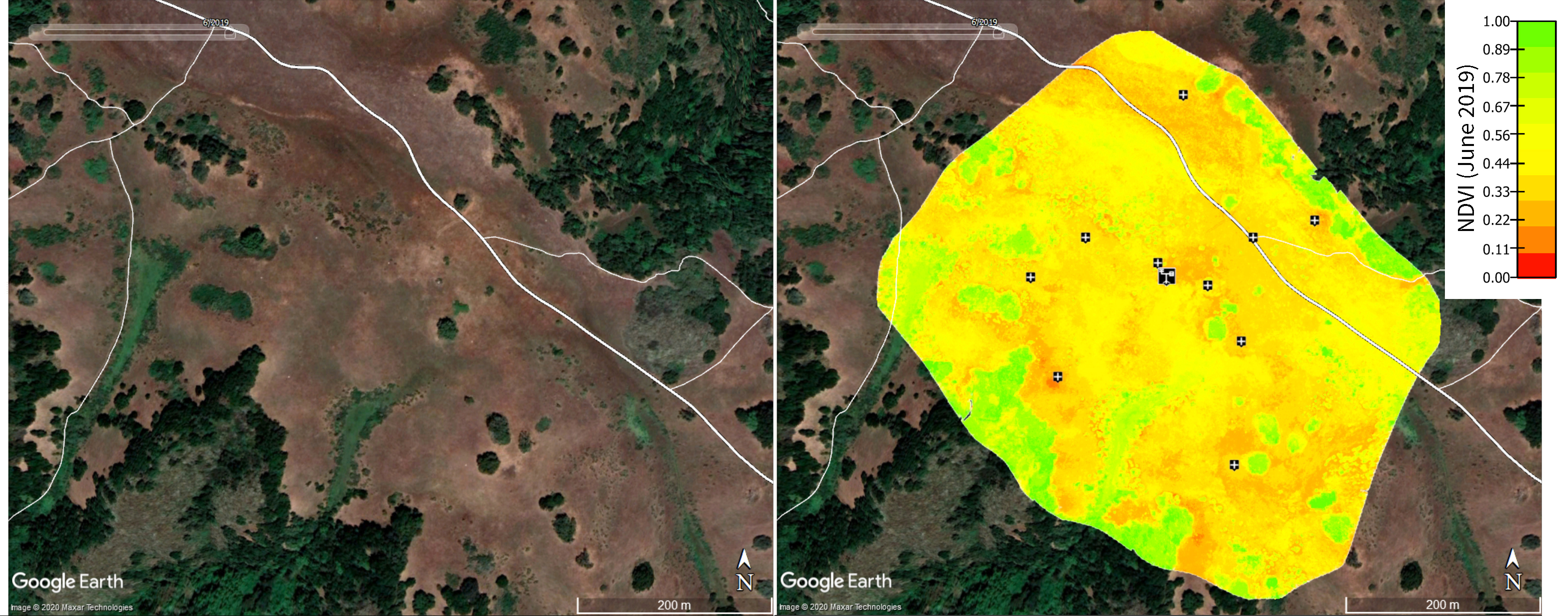
The eddy flux station integrates exchanges of water vapor and carbon dioxide over an area of grassland roughly 100m in diameter. As an intermediate step between the station and remote monitoring of vegetation by satellite or aircraft, we have monitored the Jasper Ridge grassland with drone photography. The paired images below right show a Google Earth image of the grassland during June 2019, and a map of an index of green biomass, NDVI, from the same month across 40ha of grassland from a drone equipped with cameras for different wavelengths of light. NDVI is called a greenness index and is calculated as ((Rnir - Rred)/(Rnir + Rred)) where Rred is the amount of sunlight reflected by the vegetation in the red portion of the light spectrum (where healthy plants are strong absorbers), and Rnir is the amount of sunlight reflected in the near-infrared portion (where healthy plants are strong reflectors). In the image below right, the eddy flux station is indicated by the symbol in the middle of the right panel; the “+” symbols indicate the locations of ground control points and check points for georeferencing. Each control point is a 1m x 1m white “+” anchored to the ground. Some of the controls points are detectible in the Google Earth image in the left panel as small bright points.
Project Location (Sector 33)
 |  |  |  |  |  |  |  |  |
 |  |  |  |  |  |  |  |  |
 |  |  |  |  |  |  |  |  |
 |  |  |  |  |  |  |  |  |
 |  |  |  |  |  |  |  |  |
 |  |  |  |  |  |  |  |  |
Useful Links
Visible from Trail/Road
F - Grassland Fire Road


