
Site Characterization
Location: A low ridge in the eastern foothills of the Santa Cruz Mountains at the base of the San Francisco Peninsula, 7 kilometers west of the main Stanford University campus, San Mateo County, CA.
Latitude: 37.404001°N
Longitude: 122.228781°W
USGS Maps: Palo Alto 7.5' shows the entire preserve; Woodside and La Honda 7.5' include the rest of the San Francisquito Creek watershed.
Size: 483 hectares (1,193 acres) owned by Stanford University. Maximum East-West dimension about 4 km; maximum North-South dimension about 2 km.
Elevation: 61.6 - 211.5 meters (202.1 - 693.9 feet)
Climate: Mediterranean.
Precipitation: 652 millimeters (26 inches) per year for water years 1975-2004.
Topography: the preserve covers the northern half of Jasper Ridge, a long, flat-topped ridge with a northwest-southeast axis within the San Francisquito Creek watershed. Northeast and southwest exposures flanking the ridge drain into streams, wetlands, or a eutrophic lake within the Preserve.
The south half of what is referred to as Jasper Ridge is outside the preserve boundary and part of the Town of Portola Valley
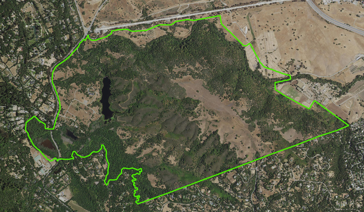
Aerial view of Jasper Ridge Biological Preserve

Location of Jasper Ridge Biological Preserve in relation to main Stanford University campus and surrounding communities