Camera-trap monitoring of mammals

Summary
The consequences of mammal activity are nearly ubiquitous at JRBP; they include distinctive browse lines on vegetation, animal trails and tracks, scat, dens, and carcasses. Yet little is known about the populations of large mammals in the Preserve, even for the frequently sighted black-tailed deer. This study is the first systematic, Preserve-wide survey of the activity of large mammals at JRBP and will help determine what mammals are present, and where and when they are active. Eventually the study may include tagging of animals so that population sizes can be estimated.
The study is led by Prof. Rodolfo Dirzo, an authority on the consequences of the loss of large mammals (termed defaunation) in the tropics. In contrast, the San Francisco Bay area appears to be seeing increased abundance of some large mammals, including mountain lions. Both types of change can have important consequences for ecosystems.
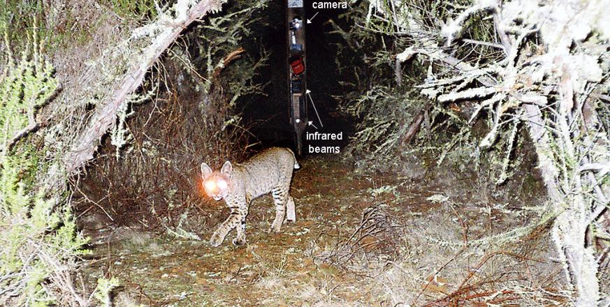
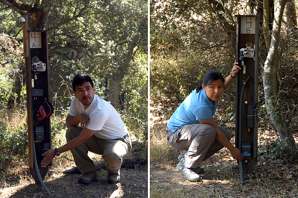
The core of the study at JRBP is a dozen "camera traps" distributed on a hexagonal grid that covers the preserve. Each station has two posts 10 meters apart; each post is mounted with a camera, infrared beam, and detector, all facing the opposite post. An animal crossing between the posts interrupts one or both beams, which are at different heights, and either beam triggers both cameras. The design was developed by a team led by docent Bill Gomez based on nearly a year of testing various combinations of cameras and sensors. The current design uses film cameras and has performed consistently, yielding stunning photos of deer, bobcats, raccoons, skunks, owls, and jays. A companion study is testing the feasibility of using digital single-lens reflex cameras.
This study will provide important information on questions ranging from the role of herbivores in shaping the vegetation at JRBP, to the conservation status of predators, to the behavior of species that are vectors of disease.
Project Location (Sectors 12, 13, 14, 15, 16, 20, 21, 22, 23, 24, 25, 29, 30, 31, 32, 33, 34, 35, 36, 38, 39, 40, 41, 42)
 |  |  |  |  |  |  |  |  |
 |  |  |  |  |  |  |  |  |
 |  |  |  |  |  |  |  |  |
 |  |  |  |  |  |  |  |  |
 |  |  |  |  |  |  |  |  |
 |  |  |  |  |  |  |  |  |
Useful Links
Visible from Trail/Road
13 - Causeway
C - Lower Fire Road


