
Bay Area Regional Deformation Network (BARD) Station, JRSC
 and power station")
Summary
A very precise and accurate GPS (global positioning system) can be vital to understanding earthquake hazards because it can reveal information that is invisible to seismometers--crustal movement that occurs over long time scales and is associated with crustal deformation and buildup of strain along faults. Pairing a seismometer with a very accurate GPS captures the full bandwidth of fault motion and crustal deformation associated with earthquake hazards.
A GPS antenna installed at JRBP in 2011 forms such a pair with the seismic station just west of Searsville Lake. Operated by the Berkeley Seismological Laboratory, the USGS and Stanford University, the combined seismic/GPS station at Jasper Ridge (JRSC) is one of 32 stations that form the Bay Area Regional Deformation (BARD) network. The primary goal of the network is to monitor crustal deformation across the Pacific-North American plate boundary and in the San Francisco Bay Area for earthquake hazard reduction studies and rapid earthquake emergency response.
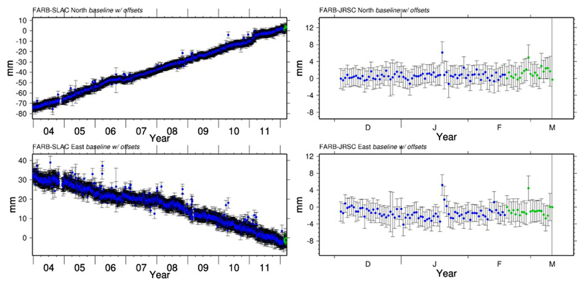
Data from the network are used to determine the relative motion of stations. For example, the Farallon Islands station (FARB), located on the Pacific plate, is moving north and west relative to the station at the SLAC Linear Accelerator Center (SLAC), located on the North American plate. The divergence of the two stations is shown in the left half of the figure at left, with north-south motion in the upper panel and east-west motion in the lower panel. The first few months of data for the motion of FARB relative to JRSC are shown in the right half. Over the longer term, FARB is expected to move about 1cm per year north relative to JRSC and about 0.5cm west per year.
JRSC's ridgetop location provided excellent GPS satellite reception along with exposed bedrock for anchoring the GPS antenna. Data from the JRSC station are continuously transmitted to UC Berkeley and the USGS via the Jasper Ridge outdoor wireless mesh network.
Project Location (Sector 23)
 |  |  |  |  |  |  |  |  |
 |  |  |  |  |  |  |  |  |
 |  |  |  |  |  |  |  |  |
 |  |  |  |  |  |  |  |  |
 |  |  |  |  |  |  |  |  |
 |  |  |  |  |  |  |  |  |
Useful Links
Visible from Trail/Road
F - Grassland Fire Road