Developing and testing optical methods for continuous monitoring of methane above Searsville Reservoir

Summary
This study is a field test of instruments being developed at Stanford to monitor atmospheric methane over distances of 100 meters to several kilometers. The Jasper Ridge test site is the main lake of Searsville Reservoir.
Atmospheric methane (CH4) is the second most significant greenhouse gas and is increasing at a troubling rate. There are many uncertainties about methane sources, including natural sources such as wetlands. To reduce the uncertainties in methane emissions, and to monitor their spatial and temporal variability, techniques are needed for monitoring methane continuously and at the scale of ecosystems. Jasper Ridge provides a test location with a spatial scale that is comparable to that of many natural and anthropogenic methane sources, such as agriculture, landfills, biomass burning, and wetlands.
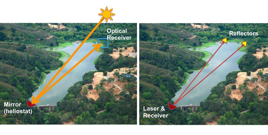
The team for this experiment combines expertise in long-path optical methane sensors (Hollberg lab) and ecosystem biogeochemistry (Hoyt lab). Their test at Jasper Ridge focuses on two optical setups for methane monitoring, illustrated above:
(1) using the Sun as the source of light to measure the Earth’s atmospheric absorption of methane near 1650 nm. In this illustration, the sun is reflected off a mirror on the dam to an optical receiver near the other end of the reservoir.
(2) direct diode-laser absorption spectroscopy of methane at 1650 nm. In this method a laser will traverse Searsville Reservoir over two or more paths and retro-reflect back to the source for detection (in this illustration, at the dam). All laser light will be low power and eye-safe.
Both setups integrate the absorption signal over a relatively long path to obtain a larger signal, just as many scientific instruments bounce light back and forth within a device to achieve an effective long path inside the instrument.
 The Searsville Reservoir work will test the potential for cost-effective measurement of reservoir and wetland methane emissions, which are highly variable in space and time. The goal is to capture “hot moments” of high methane emissions, while also measuring average emissions integrated over larger spatial scales.
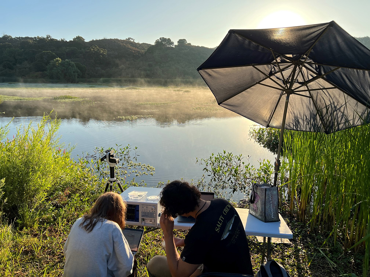
In the photograph at right, students Olivia Walsh and Liam Harrison track the signal in the 1650nm region shortly after sunrise, facing east from the boat launch. An alternative configuration will couple the boat launch and the dam, as in one of the diagrams at the top of the page.
Project Location (Sectors 21, 22, 30, 31)
 |  |  |  |  |  |  |  |  |
 |  |  |  |  |  |  |  |  |
 |  |  |  |  |  |  |  |  |
 |  |  |  |  |  |  |  |  |
 |  |  |  |  |  |  |  |  |
 |  |  |  |  |  |  |  |  |


